LiDAR: surrounding geometry
Distance measurements describe the surfaces around the scanner. Coverage depends on the sensor’s field of view, range, and visibility of the target.

Multi-Sensor Fusion
LiDAR, cameras, and motion sensors contribute different information to a scanning workflow. Bringing these inputs together supports mapping and colorized outputs; the available sensors and processing depend on the scanner configuration.
Complementary inputs
Distance measurements describe the surfaces around the scanner. Coverage depends on the sensor’s field of view, range, and visibility of the target.
Inertial measurements describe motion during capture. They complement geometric observations in the supported mapping workflow.
Images provide surface appearance for colorized outputs and visual review. Lighting, exposure, and visibility affect the quality of the captured imagery.
Positioning data adds another input where the hardware and workflow support it. Cobra includes standard RTK; results depend on corrections and field conditions.
How it works
Acquire the sensor observations available on the selected scanner.
Relate observations in time and in the sensors’ coordinate frames.
Refine the map and registration using the supported processing tools.
Associate captured imagery with geometry for the final output.
This is a conceptual sequence. Timing, calibration, and optimization methods vary by product and software version.
In practice
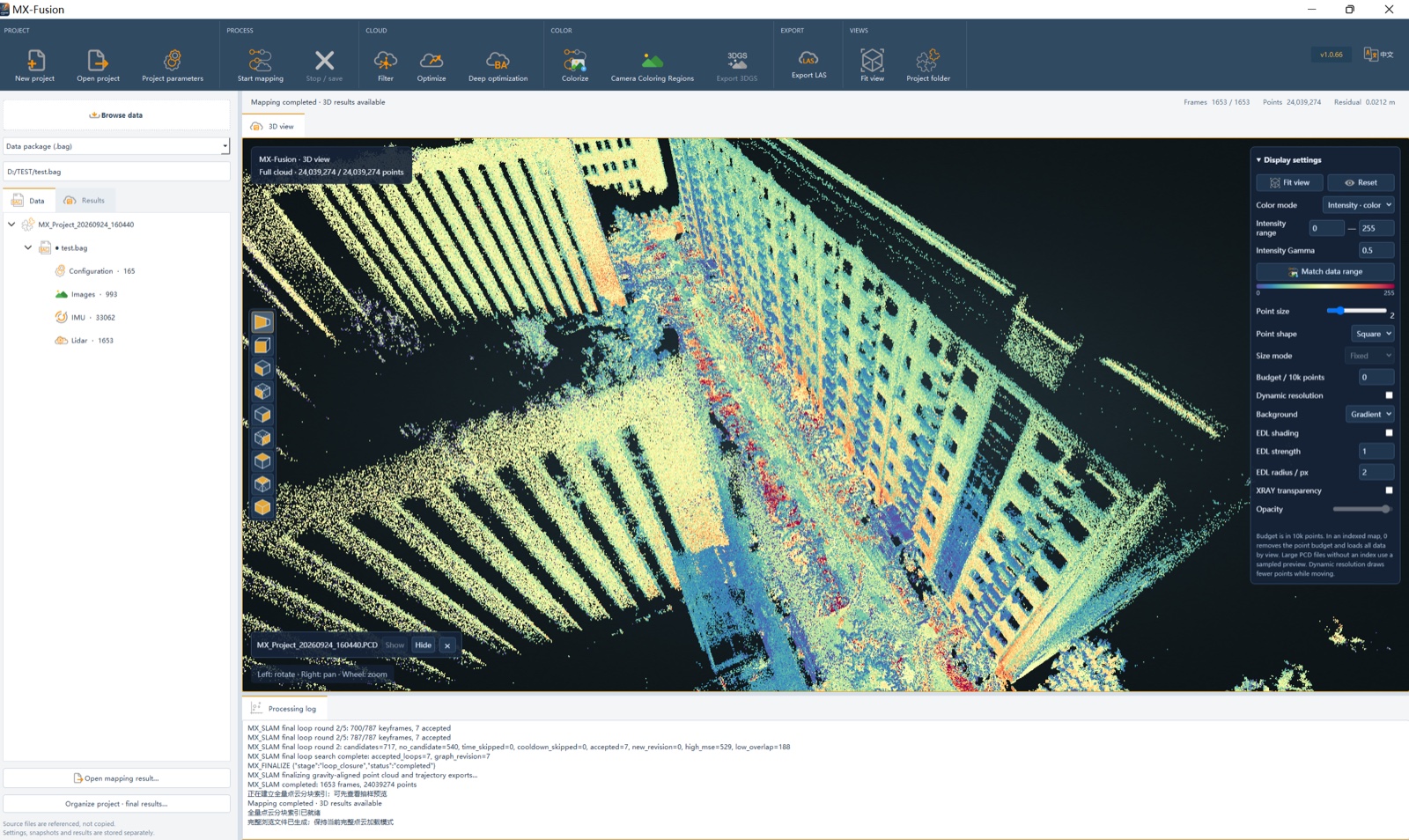
Cobra combines LiDAR, IMU, multi-view cameras, and standard RTK. Its MX-Fusion workflow includes alignment, registration, outlier removal, and color balancing to produce colorized point clouds.
Practical evaluation
Sensor configurations vary by model. Cobra S and Cobra X include standard RTK; confirm the hardware and positioning workflow for other products.
Fusion brings different sensor observations together; SLAM estimates movement while building a map. The two can work together in a mapping system. Explore LiDAR and SLAM →
The Cobra S Mid360 LAS sample lets you examine a supplied colorized point cloud. It is a processed example, rather than the full set of raw sensor inputs. Review the Cobra S sample →