Accessible asset geometry
Document visible equipment, corridors, and surrounding structures.

Utilities & Telecommunications
Match capture to the asset: use the MX-100 for manhole interiors and handheld scanning for accessible corridors, equipment spaces, and surrounding infrastructure. Agree how spatial records will connect to the existing asset register.
The project challenge
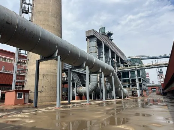
A network record may need both an interior inspection and context around the asset. Distinguishing those tasks helps teams choose the capture system, identify access constraints, and deliver information that maintenance and upgrade teams can reuse.
Useful deliverables
Document visible equipment, corridors, and surrounding structures.
Use the dedicated MX-100 workflow for interior visual and spatial records.
Agree identifiers, coordinates, and supporting files for maintenance planning.
From planning to handover
Separate manhole interiors, accessible spaces, and any concealed-asset investigation.
Plan handheld routes and dedicated manhole inspection where each is appropriate.
Review geometry and associate the records with the intended asset references.
Check formats and asset fields before handing data to the receiving team.
Project requirements
Relevant systems
Use the dedicated interior capture and inspection workflow for suitable utility and telecom manholes.
Explore MX-100 →Evaluate sensor configurations and processed point-cloud outputs for accessible site and equipment-space documentation.
Explore Cobra S & X →Consider 360° coverage for visible geometry around complex industrial equipment and structures.
Explore Radix →Evaluate the selected hardware and processing configuration using the project’s environment, required detail, and deliverables.
Related reading and resources
Review the interior capture, processing, and reporting workflow.
Explore Dedicated manhole inspection →See how visible structures and piping were recorded at a facility.
Explore Industrial documentation example →Check formats before planning import into asset software.
Explore Exchange requirements →Direct LiDAR scanning records visible surfaces. Use appropriate utility records and separate investigation methods for buried routes.
Confirm the receiving system’s coordinate reference, file formats, asset schema, and import procedure. Any custom integration needs separate confirmation.