Site point clouds
Review visible structures, equipment, and surrounding geometry in a shared spatial record.

Engineering Surveying
Document accessible site geometry and turn field observations into spatial data for engineering review. Plan the required control, coordinate system, and tolerances alongside the scanning route.
The project challenge
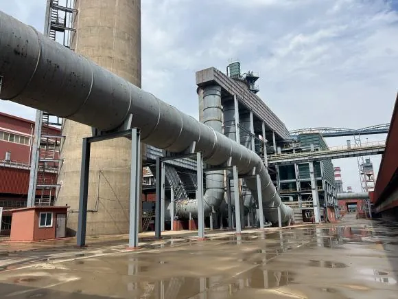
Industrial layouts, overhead structures, and connected indoor and outdoor spaces can be difficult to document from a small number of positions. A handheld route can add dense spatial context while the survey plan defines how that data is referenced and checked.
Useful deliverables
Review visible structures, equipment, and surrounding geometry in a shared spatial record.
Agree control and independent checks before relying on dimensions for engineering decisions.
Confirm units, coordinates, attributes, and file formats with the receiving engineering team.
From planning to handover
Specify extent, reference system, control, tolerances, and required files.
Plan overlapping routes around structures and accessible equipment.
Review registration, coverage, and agreement with project control.
Export the agreed data with coordinate information and validation notes.
Project requirements
Relevant systems
Compare sensor configurations, standard RTK, and MX-Fusion point-cloud processing for connected site capture.
Explore Cobra S & X →Consider its 1.2 kg weight and 360° × 59° coverage for portable documentation of connected spaces.
Explore Pentra →Evaluate 360° capture around industrial structures; confirm the installed sensor and its performance conditions.
Explore Radix →Evaluate its directional field of view and stated reflectivity conditions when planning longer-distance observations.
Explore Staris →Evaluate the selected hardware and processing configuration using the project’s environment, required detail, and deliverables.
Related reading and resources
See the capture context and outputs from the Yingkou project.
Explore Industrial facility documentation →Understand the relationship between measurement and movement estimation.
Explore LiDAR and SLAM →Check the exchange formats required by your engineering software.
Explore Data compatibility →Define the control and validation method for the intended use. Dense geometry and a stated sensor specification alone do not establish project accuracy.
The Cobra S LAS sample lets your team inspect a processed colorized point cloud. Review its coordinate notes before combining it with other project data.