Offline environment maps
Inspect captured geometry in the software used for the research workflow.

Robotics & Autonomous Systems
Use captured environments to evaluate offline mapping, spatial representation, and downstream development workflows. Confirm the available data, licensing, and interfaces before treating a scanner as a development platform.
The project challenge
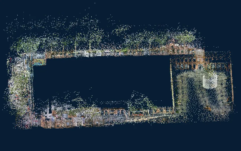
A processed point cloud can be useful for environment review and offline research. Live navigation also depends on runtime access, timing, interfaces, software, and system validation that need explicit product-level confirmation.
Useful deliverables
Inspect captured geometry in the software used for the research workflow.
Agree how the dataset will be transformed, referenced, and evaluated downstream.
Confirm delivered files, coordinate conventions, licensing, and any source-data availability.
From planning to handover
Identify offline mapping, simulation input, or a proposed live integration.
Agree formats, attributes, coordinates, licenses, and required interfaces.
Inspect the supplied file and test the intended downstream conversion.
Validate any live access, mounting, synchronization, or SDK needs separately.
Project requirements
Relevant systems
Start with the supplied processed LAS sample and discuss any additional data or interface requirements.
Explore Cobra S & X →Evaluate portable environment capture where its supported exports match the offline research task.
Explore Pentra →Assess a 360° capture configuration for mapping geometry, subject to confirmed data access.
Explore Radix →Evaluate the selected hardware and processing configuration using the project’s environment, required detail, and deliverables.
Related reading and resources
Review file format, point count, and coordinate notes.
Explore Processed dataset example →Understand how capture inputs differ from delivered outputs.
Explore Sensor inputs and processing →Confirm what the chosen workflow can exchange.
Explore File and interface requirements →An exported recording or point cloud does not define a supported live ROS interface. Confirm message access, drivers, timing, licensing, and supported versions for the intended integration.
Any real-time obstacle-avoidance capability, interface, and system validation require explicit confirmation. This page describes spatial dataset evaluation for mapping and development.