Visible scene geometry
Record accessible areas and the relationships between surrounding surfaces.

Public Safety
Evaluate portable scanning for scene documentation, post-event spatial review, training, and planning. Define the intended use and validation requirements before selecting capture and processing tools.
The project challenge
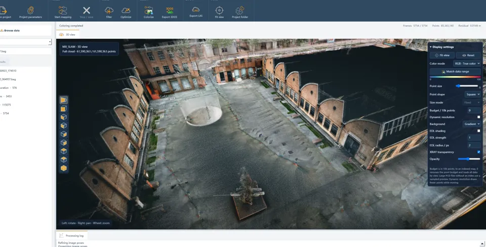
A scene may change after the field visit. A dated spatial record can help teams revisit visible geometry, but the collection procedure, supporting evidence, and validation need to match the decisions the record will support.
Useful deliverables
Record accessible areas and the relationships between surrounding surfaces.
Keep relevant imagery, notes, identifiers, and capture conditions with the record.
Check dimensions against the intended use and an agreed verification method.
From planning to handover
Agree documentation, planning, training, or other authorized purposes.
Identify scene boundaries, movement, obstructions, and permitted routes.
Check coverage and retain the source material required by the procedure.
Provide reviewed outputs, capture notes, access controls, and relevant limitations.
Project requirements
Relevant systems
Evaluate field preview and sensor choices for documenting accessible site geometry.
Explore Cobra S & X →Consider a portable 360° capture workflow for connected interior and exterior spaces.
Explore Pentra →Assess its directional coverage and range conditions for suitable larger outdoor scenes.
Explore Staris →Evaluate the selected hardware and processing configuration using the project’s environment, required detail, and deliverables.
Related reading and resources
Understand movement, coverage, and environmental factors.
Explore Capture planning →Assess which representation and measurements the workflow needs.
Explore Review spatial outputs →Evaluate a point-cloud file before planning a use-specific demonstration.
Explore General mapping sample →Certification and suitability for a particular evidentiary procedure need explicit confirmation. Define the applicable requirements and validation with qualified personnel before procurement.
Define scanning as part of the authorized procedure, with the supporting records, checks, and professional review required for the intended use.