Spatial baseline
Create a dated geometric reference of the visible areas captured.

Digital Twins
Use captured geometry and visual context as inputs to an asset’s digital record. Plan how the spatial baseline will be modeled, linked to asset information, and updated throughout the project.
The project challenge
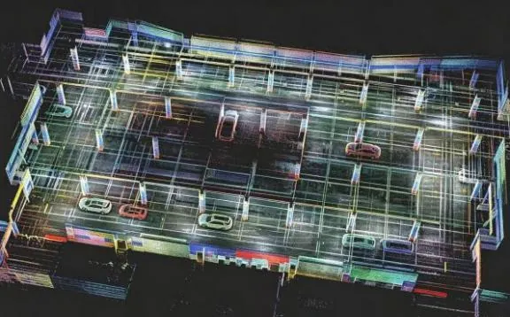
A useful digital record needs a purpose, ownership, and an update process. Define which decisions depend on the spatial data and how that data will relate to asset identifiers, documents, and the platform used by the team.
Useful deliverables
Create a dated geometric reference of the visible areas captured.
Agree which identifiers, documents, and attributes must accompany the geometry.
Define ownership, reference coordinates, and a method for later recapture.
From planning to handover
Identify the assets, users, platform, and required level of detail.
Record accessible geometry with planned coverage and reference information.
Process outputs and complete the agreed modeling and asset-linking work.
Assign update responsibilities and document revisions and capture dates.
Project requirements
Relevant systems
Evaluate MX-Fusion colorized point clouds and supported 3D Gaussian outputs for the intended visualization workflow.
Explore Cobra S & X →Consider portable capture of connected spaces when building or refreshing the baseline.
Explore Pentra →Assess 360° capture around complex visible equipment and infrastructure.
Explore Radix →Evaluate the selected hardware and processing configuration using the project’s environment, required detail, and deliverables.
Related reading and resources
Explore a project that uses captured geometry for spatial documentation.
Explore Underground parking project →Compare point clouds, meshes, and downstream deliverables.
Explore Choose the representation →Plan the capture and modeling brief for a building project.
Explore Existing-condition capture →The scanner and processing workflow provide spatial inputs. Asset linkage, operational data, platform integration, and ongoing updates need their own project scope.
Choose around the receiving platform and task. Point clouds, meshes, and visualization outputs have different uses and software requirements.